The Pacific Ocean is bigger than it looks!
Yesterday I decided I should start planning a route for this crazy voyage. So I fired up Google Earth and Wikipedia, and started tagging interesting places, drawing lines, and measuring distances. As I scanned around the Pacific Ocean, zooming in and out, I came to the realization, however obvious it should have been, that the Pacific Ocean is crazy huge! The distances between islands, countries, and points of interest are measured in thousands of miles.
Based on my early research, it seems most people taking on this quest make their way down toward Mexico, then head west toward French Polynesia (with detours to the Galapagos or Easter Island), the make their way toward Tonga, Fiji, and New Zealand. Then on the return, head north east to Hawaii, and then the long haul back to the US West Coast. There are myriad places to stop and explore along the way and it’s hard to even plan where you may stop due to unknowns such as winds/weather, time, and just plain curiosity. For now I marked stops at places that had some civilization, places where sundries could be obtained and/or maintenance done if needed. But depending on how things are going, we could easily detour to any number of the hundreds of islands and motus scattered across the South Pacific.
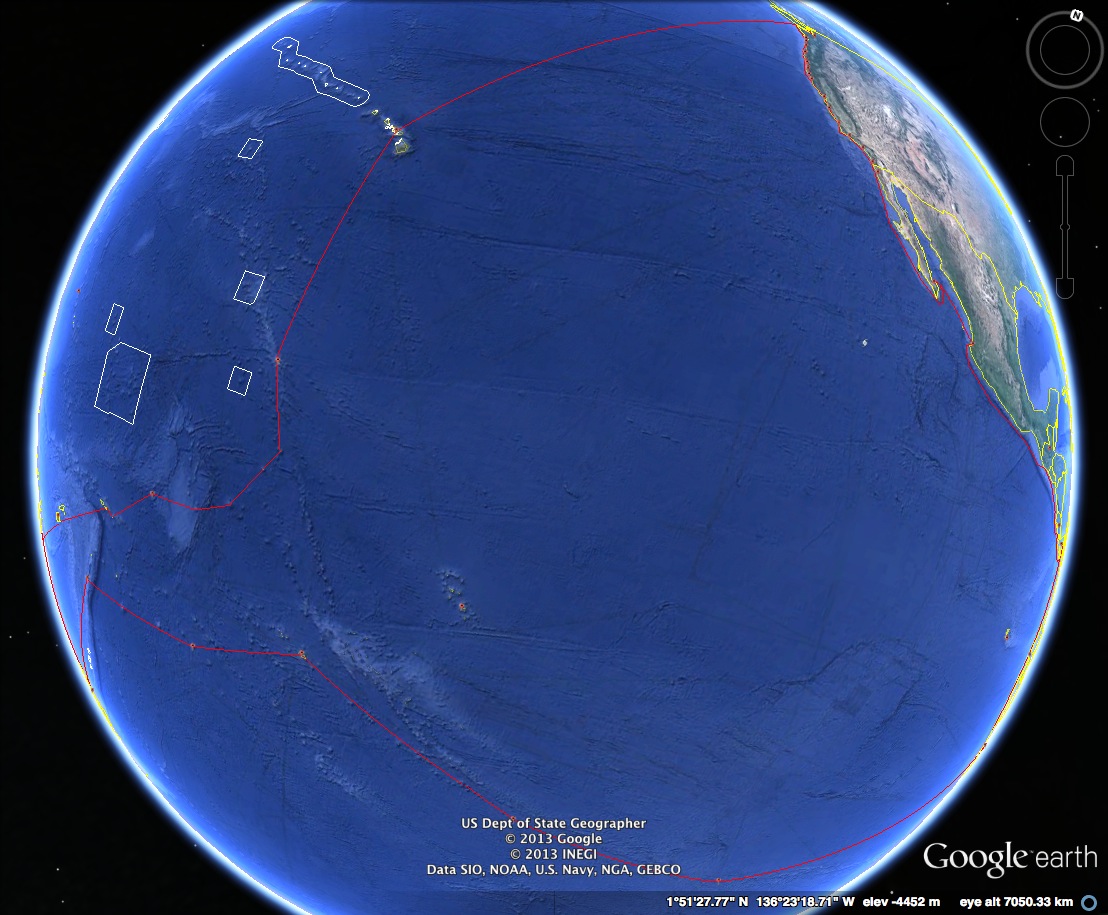
Take a look at this route.. The far upper right is the Pacific Northwest (ie: Seattle) and the far lower left is New Zealand. You can probably recognize Hawaii in the upper middle as well. Other places of interest include Tonga, Samoa, Fiji, Tahiti, Easter Island, Kiribati, New Caledonia, Guatemala, Costa Rica, Peru, Mexico, and so much more. There are really some amazing places to see, and some of them are just tiny islands with a few natives, or completely uninhabited. The amazing thing about this image from Google Earth is that the view is what a satellite would see looking down on the Pacific Ocean from space, and the route barely fits in the view. It’s a bit overwhelming.


